-

2022 FOSS4G Keynote Speech
-
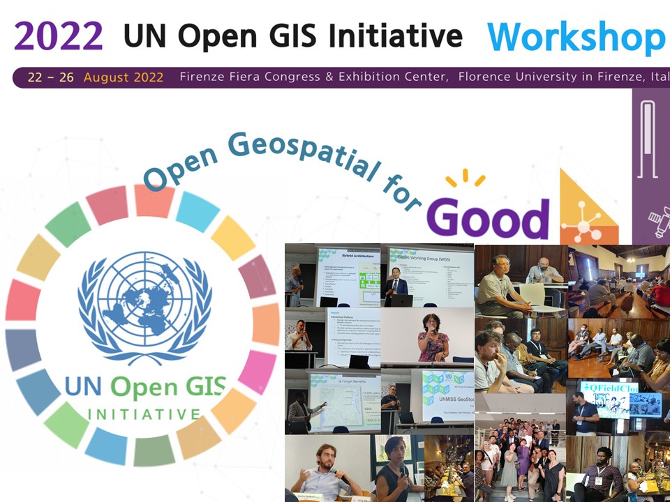
2022 UN Open GIS Initaitive Workshop in Firenze, Italy
-
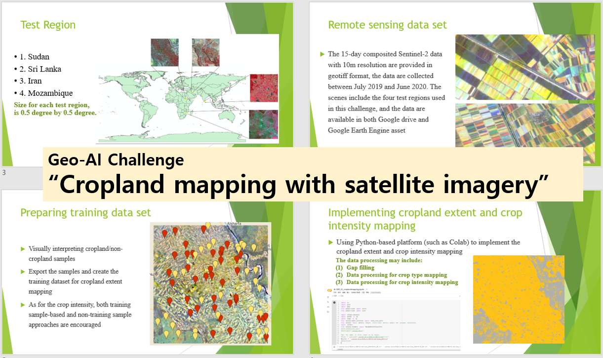
WG5: GeoAI Challenge for Cropland Mapping with Satellite Imagery curated by FAO
-
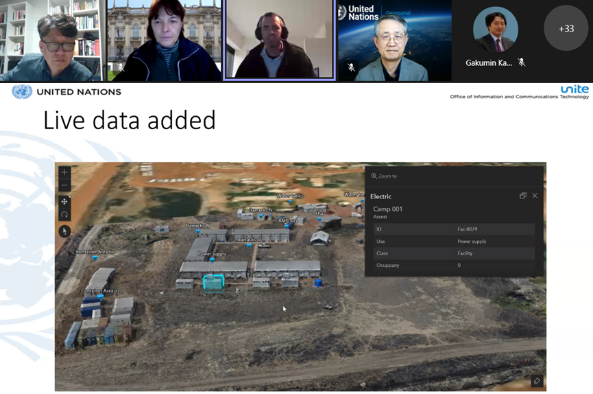
'UN Live Map' for the 'Digital Twin of UN Camp', built by using OpenDroneMap
-
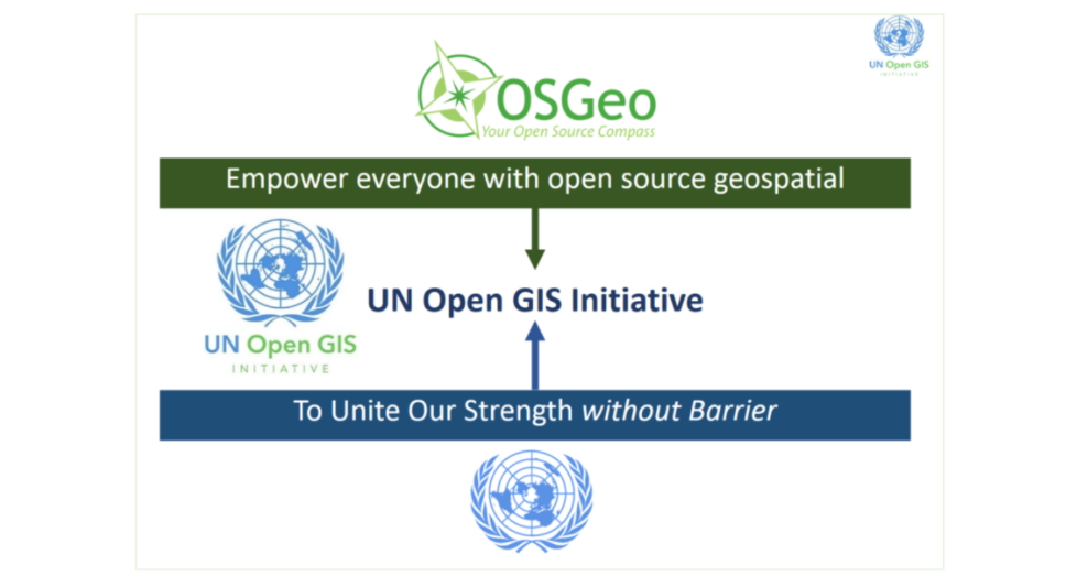
Goal of UN Open GIS Initiative
-
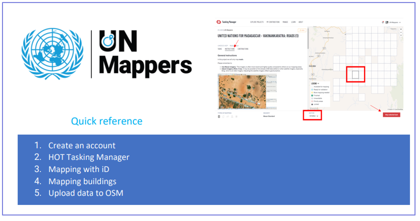
Download a Quick Reference Guide for UN Mappers
-
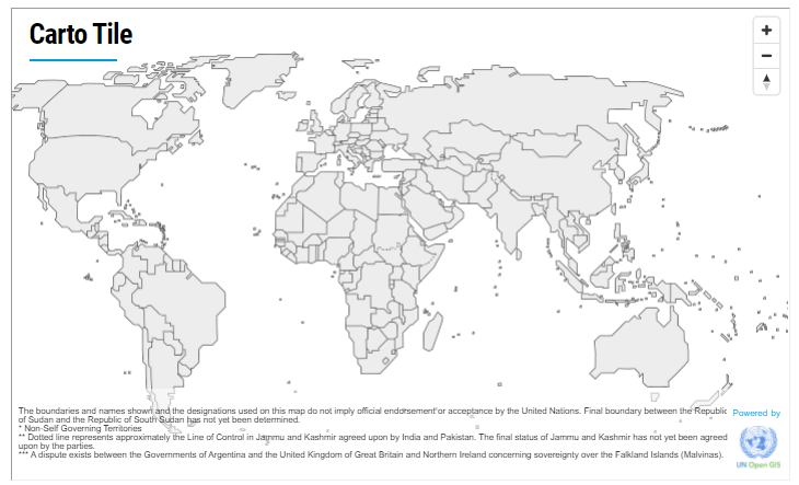
'Carto Tile' web service provided by the UN Geospatial and powered by UN Open GIS Initiative
-
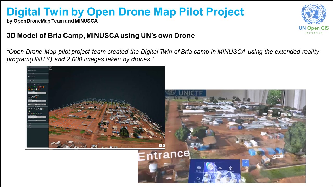
Digital Twin of Open Drone Map
-
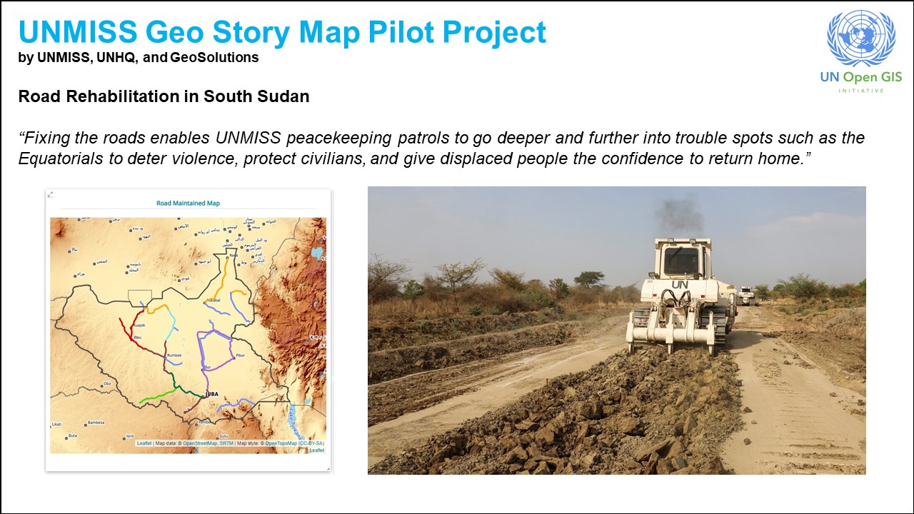
UNMISS Geo Story Map Pilot Project
-
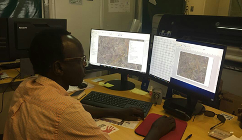
QGIS used by Malakal GIS Team in the United Nations Mission in South Sudan (UNMISS)
LATEST UPDATES
- ·Working Groups of UN Open GIS Initiative (Feb 2024)
- ·[JOB-MINUSMA] ASSOCIATE DATA SCIENTIST, P2
- ·[JOB-UN Mappers] Social Media Manager and Interns
- ·UN Maps conference in Valencia, Spain (6 - 10 March 2023)
- ·[JOB-FAO] Information Technology Officer (Geospatial Analysis, Data Visualization), P2 at FAO (Rome, Italy)
IN FOCUS
![[Best Practice] Mapping Refugee Settlements by using PulseSatellite](/sboard/data/image/Uploadify_202002121349058190.jpg)
[Best Practice] Mapping Refugee Settlements by using PulseSatellite
Figure1. Refugee Camp mapping with using PulseSatelliteCounting and classifying structures in a refugee settlement is a common analysis task for humanitarian agencies. In practice, this is currently manually done by human expert analysts using satel… MORE![[Best Practice] Implementing the UN Open GIS Initiative in United Nations Mission in South Sudan](/sboard/data/image/201912201932569846.jpg)
[Best Practice] Implementing the UN Open GIS Initiative in United Nations Mission in South Sudan
Implementing the UN Open GIS Initiative in United Nations Mission in South Sudan By Majur Achiew (GIS Assistant) and Remi Kouakou (GIS Officer), UNMISS Following the UN Open GIS training course for QGIS and PostGIS, which was contributed by the UN… MOREAbout Us
UN Open GIS initiative is to identify and develop an Open Source GIS bundle that meets the …. MORE
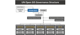
Governance Structure
UN Open GIS initiative consists of Co-Chairs, Secretariat Office, Technical Advisory Group, Requirement Advisory Group and four... MORE